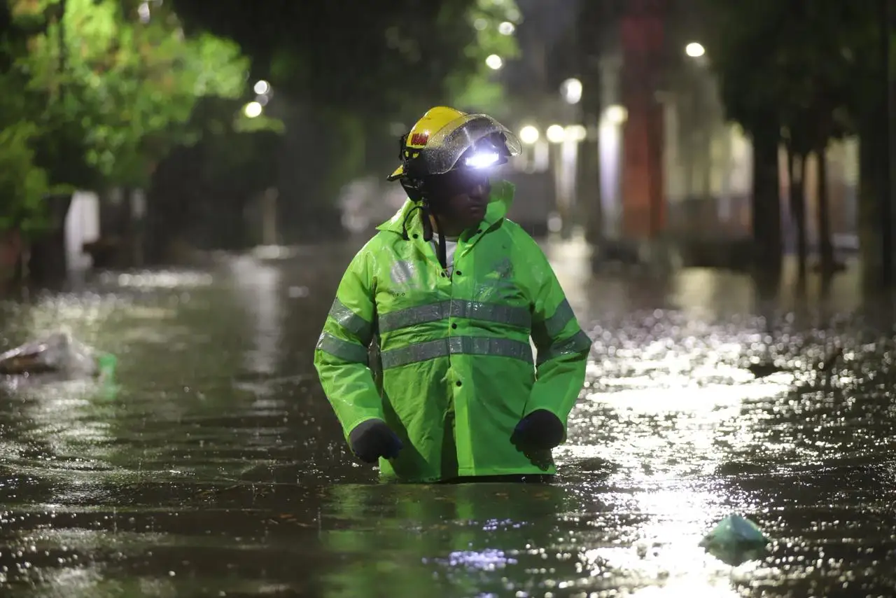

The Guadalajara Metropolitan Area (AMG) is facing a growing crisis of flooding and property damage due to decades of misguided technical decisions, soil sealing caused by uncontrolled urban growth, and the lack of comprehensive water management. This is what specialists from the University of Guadalajara (UdeG) and affected residents warn, pointing out that authorities’ solutions have been insufficient and that the problem worsens with every rainy season.
The Comprehensive Flooding Map of the Guadalajara Metropolitan Area records an increase of 70 flood-prone areas and 35 high-danger points in the latest update of processed data corresponding to 2025 (since the current rainy season is still underway): the former increased from 600 to 670, while critical points rose from 200 to 235.
The problem is related to decades of urban expansion, soil sealing, and technical decisions that have altered natural waterways and exceeded the capacity of drainage collectors.
The study, prepared by researcher Luis Valdivia Ornelas, documents more than a century of flooding in the metropolitan area and identifies areas where the danger has worsened. Among them is Parques de Santa María, in Tlaquepaque, where the overflowing of the Arroyo Seco is already causing flooding, erosion, and damage to homes.
The issue is part of the current crisis involving the quality and supply of drinking water in the metropolitan area: specialists believe that proposed solutions must be addressed comprehensively and consider not only drinking water, but also wastewater and stormwater management, as well as the recovery of infiltration zones.
Meanwhile, residents who have spent years requesting solutions from municipal, state, and federal authorities, and specialists propose recovering infiltration zones and containing water flows instead of continuing to transfer the problem through concrete infrastructure.

When the water takes away people’s property
For residents living near waterways, the rainy season has become synonymous with anxiety. Leonardo Lira, a resident of the Parques de Santa María neighborhood in the municipality of Tlaquepaque for more than 20 years, describes how the overflowing of the Arroyo Seco and the erosion of its banks directly threaten their homes.
“The creek overflows, and then it enters our homes. But it gets worse every time, the problem keeps getting bigger, the creek has been eroding. So it keeps getting closer to our homes. In fact, there are some neighbors whose homes are now less than 1 meter from the edge of the creek,” Lira explains.
The resident attributes the situation to the unchecked growth of the city toward the west and the paving of areas that were previously permeable:
“The reason is because the creek channel has now grown so much, and that is because more areas have been paved and the water has been diverted toward this creek. Construction has also taken place, and all that water ends up in the creek. So it is handling much more water than it normally did.”
Lira also denounces poor planning by the Intermunicipal System of Potable Water and Sewerage Services (SIAPA), which installed a sewage collector that does not benefit his neighborhood, but rather the one across the creek. As the creek expanded, the pipes broke, causing the channel to remain constantly filled with stagnant sewage when it is not raining. Despite requesting assistance from agencies such as SIAPA, Conagua, the State Water Commission, and municipal and state governments, the response has been nonexistent:
“None of them gives us a solution, none of them wants to take action. They all blame one another,” he denounces.

A century of bad decisions
Luis Valdivia Ornelas, a geographer, a retired UdeG research professor affiliated with the Department of Geography and Territorial Planning, and a specialist in urban risks, hydrology, and flooding, leads the development of the “Comprehensive Flooding Map,” a scientific tool with more than 100 years of historical records (dating from 1908–1911) available on the georiesgosjalisco.com platform.
The map’s update through 2025** reveals an alarming picture: the documented risk points increased from 600 to 670 flood-prone areas, while the areas considered highly dangerous rose from 200 to 235.
“They have become more dangerous, more frequent, the flood-prone areas have expanded, and in places where there used to be no flooding, new floods are now occurring,” Valdivia Ornelas explains.
The geographer explains that the real origin of flooding in Guadalajara lies in a combination of technical and political factors:
“Basically, it is due to bad decisions regarding the replacement of natural water flows with collectors and channels. That was the first technical mistake. And the second technical mistake was failing to control urban growth.”
Valdivia Ornelas regrets that authorities evade their technical responsibility by attributing flooding solely to garbage or “atypical rainfall”:
“The authorities do believe it is because of garbage and atypical rainfall. I have the idea that sometimes they really do believe that argument. Unfortunately, and this is indeed delicate, because it shows that there is a lack of rigorous technical training… a technical blindfold is being put on.”

48 years underwater
In the Tetlán Río Verde (Foviste) area, severe flooding has been recurring for 48 years. Valdivia Ornelas attributes the problem to an original decision: authorities enabled a street to function simultaneously as a channel and as a ford, a design that has never stopped failing.
The specialist calls for rigorously evaluating the hydrological impact of new real estate developments in the city’s higher and critical areas, requiring them to generate “zero hydrological impact” in order to prevent the metropolitan area from continuing to multiply its flood-prone areas and putting human lives and residents’ property at risk.

Recovering the water cycle
Arturo Gleason Espíndola, a UdeG academic and specialist in water and urban issues, maintains that the public discussion surrounding the supply and quality of drinking water cannot be separated from the management of flooding and the use of rainwater. For the researcher, the artificial system created by humans and the natural water cycle must be fully integrated.
“When development takes place without control, when the water cycle is not preserved in its functioning, in its entirety, we end up damaging the sources of supply, both in terms of quality and the reduction in the quantity of water,” Gleason warns.
The figure that connects both crises: for every 100% of soil made impermeable with concrete, more than 50% of rainwater ends up in the drainage system instead of infiltrating—and it is precisely from underground sources that nearly 40% of the water currently consumed by the city comes.
Gleason proposes reversing that proportion: of the 60% of rainwater that currently goes directly into the drainage system, at least 30% could be used through collection systems in buildings, retention in tanks, and infiltration through vegetation. “That is what is desirable,” the specialist summarizes.
He also criticizes administrations for continuing to invest in “mega-projects” that promise to solve water shortages without success, as happened with the Calderón, Arcediano, and El Zapotillo dams, and now with the second aqueduct. He warns that if there is no comprehensive intervention—with sequenced actions that preserve the water cycle and infrastructure that works properly—the deterioration will continue: “the problem is a matter of time… right now it seems like we are going downhill, but imagine if the descent becomes steeper. That is what we have to prevent.”

Urbanization and lack of capacity
In the documents titled “Strategic Plan for Comprehensive Water Management” and “Technical Bases for the Prioritization of Strategic Interventions for Water Security in the Guadalajara Metropolitan Area,” submitted by the Government of Jalisco to the state Congress, authorities acknowledge that metropolitan flooding cannot be explained solely by the intensity of rainfall or by the lack of a specific infrastructure project.
The diagnosis, prepared by state agencies such as SIAPA and the State Water Commission, indicates that urban growth modified the behavior of watersheds by replacing natural soil with pavement and buildings, which reduced infiltration and increased the speed and volume of runoff.
It also identifies two problems: stormwater infrastructure that has lost capacity due to lack of maintenance, sedimentation, or deterioration, and areas where existing infrastructure was no longer designed to handle the volumes of water that must be discharged due to urban growth.
The document recognizes the need to develop new infrastructure where deficiencies are confirmed, but establishes that needs and required capacities must first be determined on a watershed-by-watershed basis. It also acknowledges that the solution requires metropolitan coordination, since watersheds do not respect municipal boundaries.
The Technical Bases propose a roadmap for defining future interventions, but do not yet establish a definitive catalog of the projects to be carried out or specific investment commitments.
The 6 stormwater actions of the Water Plan
The Plan breaks down a portfolio of 32 strategic actions. Six of them make up the “Integrated stormwater management and urban resilience” component:
1. Maintenance of the city’s stormwater regulation systems — permanent program
2. Annual SIAPA Preventive Plan — permanent program
3. AMG stormwater management studies, in collaboration with the Mexican Institute of Water Technology (IMTA) — short term
4. Aquifer recharge and stormwater control project — short term
5. Addressing sinkholes and repairing collectors — short term
6. Master Plan for Stormwater Runoff Regulation in the Upper Arroyo Hondo Watershed — medium term
However, of the six actions, only the last one already identifies a specific watershed; the rest are permanent maintenance programs or studies that, according to the Plan itself, must first generate the diagnosis from which the portfolio will emerge
Source: lasillarota